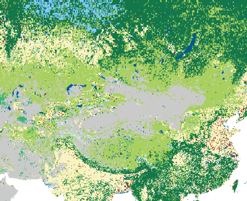

The 30-m land cover data of Tibetan Plateau (2010)

These data contain two data files: GLOBELAND30 TILES (raw data) and TIBET_ GLOBELAND30_MOSAIC (mosaic data). The raw data were downloaded from the Global Land Cover Data website (GlobalLand3) (http://www.globallandcover.com) and cover the Tibetan Plateau and surrounding areas. The raw data were stored in frames, and for the convenience of using the data, we use Erdas software to splice and mosaic the raw data. The Global Land Cover Data (GlobalLand30) is the result of the “Global Land Cover Remote Sensing Mapping and Key Technology Research”, which is a key project of the National 863 Program. Using the American Landsat images (TM5, ETM+) and Chinese Environmental Disaster Reduction Satellite images (HJ-1), the data were extracted by a comprehensive method based on pixel classification-object extraction-knowledge checks. The data include 10 primary land cover types—cultivated land, forest, grassland, shrub, wetland, water body, tundra, man-made cover, bare land, glacier and permanent snow—without extracting secondary types. In terms of accuracy assessment, nine types and more than 150,000 test samples were evaluated. The overall accuracy of the GlobeLand30-2010 data is 80.33%. The Kappa indicator is 0.75. The GlobeLand30 data use the WGS84 coordinate system, UTM projection, and 6-degree banding, and the reference ellipsoid is the WGS 84 ellipsoid. According to different latitudes, the data are organized into two types of framing. In the regions of 60° north and south latitudes, the framing is carried out according to a size of 5° (latitude) × 6° (longitude); in the regions of 60° to 80° north and south latitudes, the framing is carried out according to a size of 5° (latitude) × 12° (longitude). The framing is projected according to the central meridian of the odd 6° band. GLOBELAND30 TILES: The original, unprocessed raw data are retained. TIBET_ GLOBELAND30_MOSAIC: The Erdas software is used to mosaic the raw data. The parameter settings use the default value of the raw data to retain the original, and the accuracy is consistent with that of the downloading site.
The 30m Land Cover Data of Tibetan Plateau(2010). The Big Data Infrastructure for the Pan-Third Pole Environment.2010
[1] Chen J., Ban Y., Li S. (2014). Open access to Earth land-cover map, Nature, 514(7523), 434-434. DOI:10.1038/514434c. (查看)
To respect the intellectual property rights, protect the rights of data authors, expand services of the data center, and evaluate the application potential of data, data users should clearly indicate the source of the data and the author of the data in the research results generated by using the data (including published papers, articles, data products, and unpublished research reports, data products and other results). For re-posting (second or multiple releases) data, the author must also indicate the source of the original data. The data is downloaded from the Global Land Cover Data website (GlobalLand3) Distribution Site (http://www.globallandcover.com).
No record
No record
No record
Sign In to add comments

三江源国家公园星空地一体化生态监测数据平台 © 2018-2021 陇ICP备05000491号 | All Rights Reserved
|  京公网安备11010502040845号
数据中心技术支持: 数云软件