Drone orthophoto image and DSM of Qinghai Hoh Xil plot (2018)
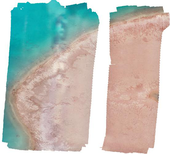
On August 22, 2018, a DJI camera was used in the fixed sample of Lancang River headwaters. The overlap degree of adjacent photos was not less than 70% according to the set flight route. The Orthophoto Image and DSM were generated using the photographs taken. The Orthophoto Image included three bands of red, green and blue, with a ground resolution of 2.5 cm, a shooting area of 1000m x 1000m and a DSM resolution of 4.5 cm. Due to the communication failure, the middle four airstrips were not photographed, so there was a band in the middle of the image missing.
To respect the intellectual property rights, protect the rights of data authors, expand services of the data center, and evaluate the application potential of data, data users should clearly indicate the source of the data and the author of the data in the research results generated by using the data (including published papers, articles, data products, and unpublished research reports, data products and other results). For re-posting (second or multiple releases) data, the author must also indicate the source of the original data.
三江源国家公园星空地一体化生态监测及数据平台(SJYNP)
1.Drone photoes of Qumalai alpine meadow plot (2018)
2.Drone orthophoto image and DSM of Qumalai alpine meadow plot (2018)
3.Drone orthophoto image and DSM of Qinghai Hoh Xil plot (2018)
4.Drone photoes of Qumalai wetland plot (2018)
5.Drone orthophoto image and DSM of Qumalai wetland plot (2018)
6.Aerial Drone photos of Hoh Xil plot (2018)
7.Rare animals survey dataset for the Three-River Headwater Region (2016-2017)
No record
No record
Sign In to add comments
Principal Investigator: WANG Xufeng WEI Yanqiang
Resource Provider: WANG Xufeng WANG Xufeng

三江源国家公园星空地一体化生态监测数据平台 © 2018-2021 陇ICP备05000491号 | All Rights Reserved
|  京公网安备11010502040845号
数据中心技术支持: 数云软件
