
新闻动态
NEWS

A new global gridded sea surface temperature data product published
Recently, Prof. MAO Kebiao's group at the Institute of Agricultural Resources and Regional Planning, Chinese Academy of Agricultural Sciences published a paper in the Earth System Science Data, entitled as "A New Global Gridded Sea Surface Temperature Data Product Based on Multisource Data". And its corresponding data product "SSTG Dataset: Global Sea Surface Temperature Gridded Data (2002-2019)" is published and shared at the National Tibetan Plateau/Third Pole Environment Data Center (http://data.tpdc.ac.cn/en/) and is available for open access.
Sea surface temperature (SST) is an important geophysical parameter that is essential for studying global climate change. Although sea surface temperature can currently be obtained through a variety of sensors, the temperature values obtained by different sensors come from different ocean depths and different observation times, so different temperature products lack consistency. In addition, different thermal infrared temperature products have many invalid values due to the influence of clouds, and passive microwave temperature products have very low resolutions. These factors greatly limit the applications of ocean temperature products in practice.
Traditional methods can only obtain sea surface temperature at a single point scale, and the sea surface temperature information obtained by a single satellite remote sensor is often incomplete and limited, which cannot fully meet the user's demand for high resolution, high accuracy and full spatial and temporal coverage datasets. Using multi-source data and its fusion technology is an effective way to obtain large scale and refined sea surface temperature values.
This research first took MODIS SST products as a reference benchmark and constructed a temperature depth and observation time correction model to correct the influences of the different sampling depths and observation times obtained by different sensors. Then, it built a reconstructed spatial model to overcome the effects of clouds, rainfall, and land interference that makes full use of the complementarities and advantages of SST data from different sensors. It applied these two models to generate a unique global 0.041∘ gridded monthly SST product covering the years 2002–2019. This dataset effectively overcomes the limitations of reconstructing real ocean temperatures under cloudy conditions in the past and the inconsistency of temporal phase and sampling depth of different data to achieve good spatial and temporal coverage. The accuracy assessments indicate that the reconstructed dataset exhibits significant improvements and can be used for mesoscale ocean phenomenon analyses. The product will be of great use in research related to global change, disaster prevention, and mitigation. Figure 1 shows a comparison of the data before and after the reconstruction in July 2005.
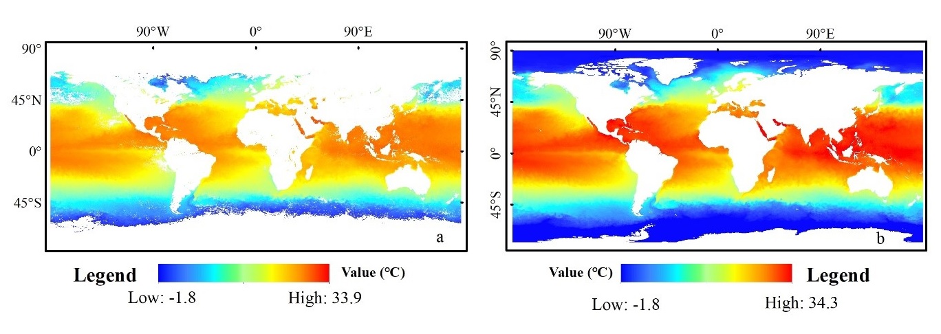
Figure 1. Comparison of the data before (a) and after (b) the reconstruction in July 2005
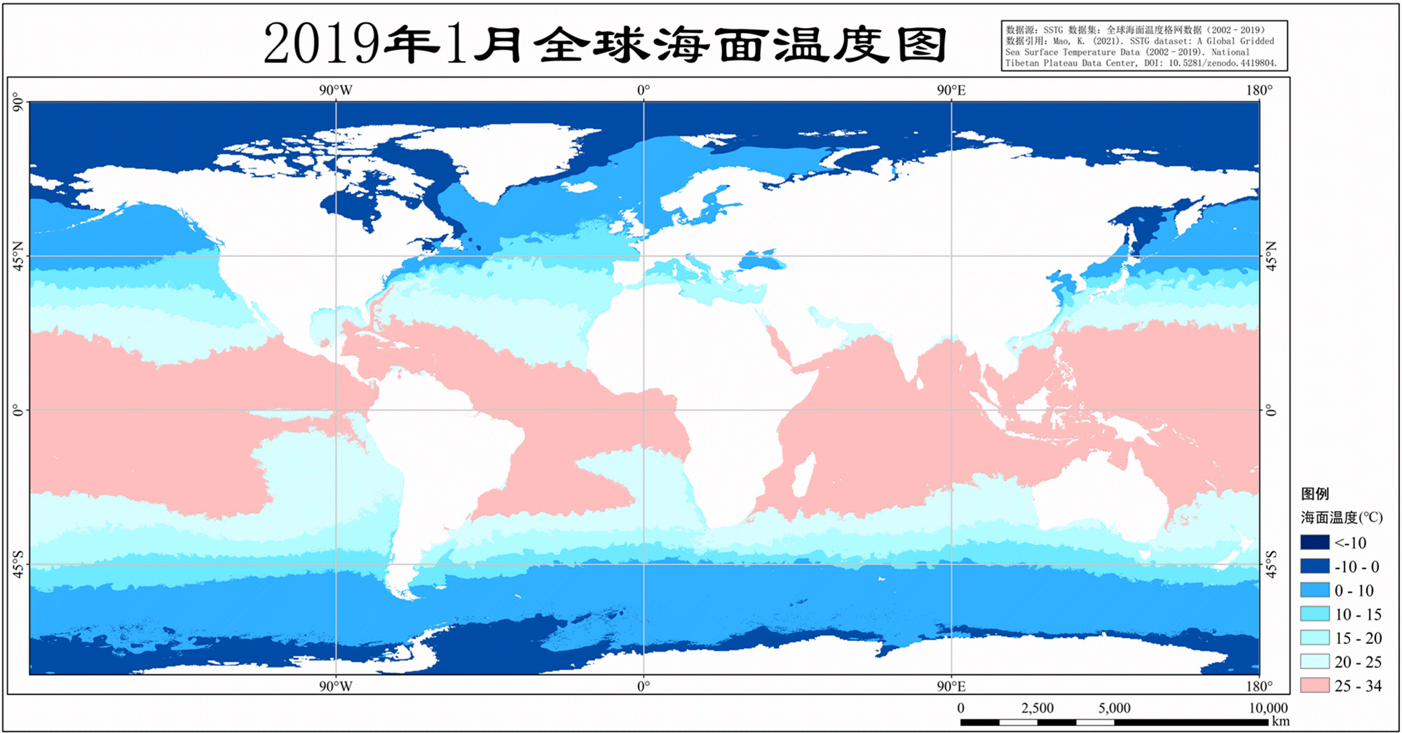
Figure 2. Monthly average SST for 2019
This work was supported by the National Natural Science Foundation of China (grant no. 41921001), National Key Project of China (grant nos. 2018YFC1506502 and 2018YFC1506602), Fundamental Research Funds for Central Non-profit Scientific Institution (grant no. 1610132020014), and Open Fund of State Key Laboratory of Remote Sensing Science (grant no. ofSLRSS201910).
Article:
Cao, M., Mao, K., Yan, Y., Shi, J., Wang, H., Xu, T., Fang, S., and Yuan, Z.: A new global gridded sea surface temperature data product based on multisource data, Earth Syst. Sci. Data, 13, 2111–2134, 2021.
Full-text available at:
https://doi.org/10.5194/essd-13-2111-2021
Data available at:
https://data.tpdc.ac.cn/en/data/f2bf6728-77fd-4309-a2a2-ed0495f68cb0/

 京公网安备11010502040845号