Land use of the Tibet Plateau in 2015 (Version 1.0)
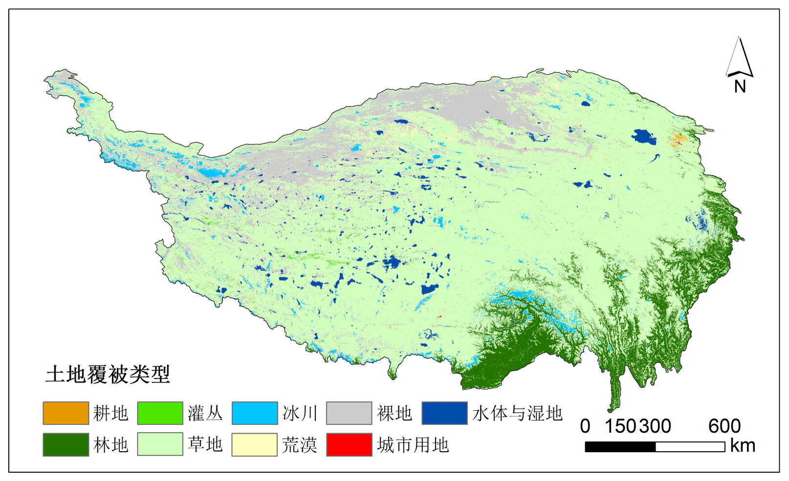
Based on 2015 ESA global land cover data (ESA GlobCover), combined with the Tsinghua university global land cover data (FROM GLC)、NASA MODIS global land cover data (MCD12Q1)、University of Maryland global land data (UMD)、USGS global land data (IGBP DISCover),we build the LUC classification system in the Tibet Plateau and the rest of the data transformation rules of the classification system. We also build the land cover classification confidence function and the rules of fusing land classification to finish the Integration and modification of land cover products and finally complet the land use data in the Tibet Plateau V1.0.
xx_datayy xx is dx,meaning the Tibet Plateau data is lu,meaning the land use yy is time,meaning the year of data
To respect the intellectual property rights, protect the rights of data authors, expand services of the data center, and evaluate the application potential of data, data users should clearly indicate the source of the data and the author of the data in the research results generated by using the data (including published papers, articles, data products, and unpublished research reports, data products and other results). For re-posting (second or multiple releases) data, the author must also indicate the source of the original data.
泛第三极环境变化与绿色丝绸之路建设专项(XDA20000000)
No record
No record
No record
Sign In to add comments
Resource Provider: XU Erqi

三江源国家公园星空地一体化生态监测数据平台 © 2018-2021 陇ICP备05000491号 | All Rights Reserved
|  京公网安备11010502040845号
数据中心技术支持: 数云软件
